Showing posts with label Family and Friends Hiking. Show all posts

5/13/12

SENIOR EXPLORERS CHECK OUT CATHEDRAL ROCKS

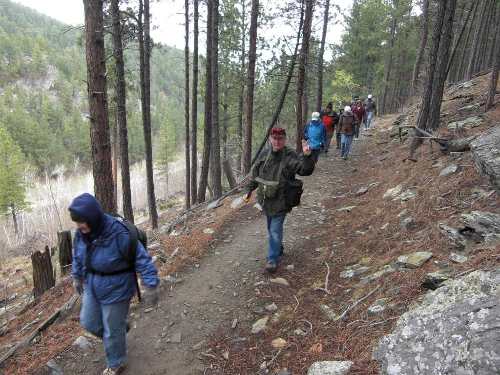
On May 12, 2012 the Black Hills Explorers were back in action.  This time visiting the cathedral-like spires of the Custer State Park near Mt. Rushmore and Sylvan Lake.  It was a beautiful day, an inspiring geologic environment, and a very rewarding outdoor exercise.

Our hike was made even more enjoyable by the exercise-savvy duo of JoAnn and John Sterner, co-directors of the new canyon lake health and fitness center in Rapid City.  At the trailhead both JoAnn and John led our eager crew in a 5-minute pre-hike flexibility workout.  Most of us agreed during the hike and upon returning from the strenuous trek expressed the opinion that the pre-hike warmup certainly did improve the overall experience (and ourselves!).


2/4/12

SENIOR EXPLORERS PURSUE THE CAVALRY

On January 14 the Black Hills Explorers set out to find the remnants of General Custer's cavalry unit.  We found plenty strong evidence at the old Fort Meade cavalry training grounds.  Starting from the Alkali Creek trail head of the Centennial trail, the Explorers hiked a few miles overland to Fort Meade for a sit-on-the-ground picnic lunch.  We also examined historical photo's and stories about how Ft. Meade was formed originally from the remaining soldiers of General Custer's unit (thanks to a great book recommended by Nila Boone, from the Canyon Lake Center's library).


En route we found an overlook to gaze down upon the Ft. Meade National Cemetery.  The turn-around destination was another overlook, one that provides a vast and dramatic panoramic view of Ft. Meade with Bear Butte in the background.  Along the way we saw historical evidence of the old cavalry training area.  


We also discovered old ruts in the prairie left over from the 1870's Sydney-Deadwood Trail.  Sidney, Nebraska was a booming freighting point when gold was discovered in the Black Hills.  (Not to mention its 80 saloons, plus gaming halls and brothels.  Initially, Sidney was the most established trading-supply point for Deadwood, the largest town in the Black Hills.  Then the trains came to the Black Hills.


And, did you know our current national anthem was first formally played officially at Ft. Meade?  Standing on the hillside overlooking Ft. Meade, imagining the thousands of pioneers who tread the wagon trails on this ground, contemplating the thousands of U.S. veterans who have served and been treated there...I could nearly hear the U.S. flag fluttering proudly in the wind at fort down below, lofting its song upon the prairie wind: 
What is that which the breeze, o'er the towering steep, 
As it fitfully blows, half conceals, half discloses?
Now it catches the gleam of the morning's first beam,
In full glory reflected now shines in the stream:
'Tis the star-spangled banner! Oh long may it wave
O'er the land of the free and the home of the brave!.


12/10/11

SENIOR EXPLORERS FIND GOLD AT SILVER CITY

Golden wintry scenery, that is.  On December 10, thirteen Black Hills Explorers went in search of outdoor adventure on Deer Creek Trail near Silver City.  What they found was a bitterly cold trail with a silver lining that evolved as the day went on, to a toasty golden sunny landscape that was seasonally decorated with beautiful ice formations of all shapes and sizes along Rapid Creek.

The trek crisscrossed six impressive heavy-timber pedestrian bridges, and passed between deep, vertical canyon walls of rock warmed by the direct rays from a low winter sun.

The entire trail is on an old railway bed, with smooth surface and gradual slope.  However, that did not prevent having to deal with slippery footing on ice and snow.  As part of the day’s adventure, trip leader Lee Alley provided a short seminar on how to select and use snow shoes on various trail conditions such as found that day.


To learn of next month’s program, see the Black Hills Explorers’ web site, www.BlackHillsExplorers.org or call group leader Lee Alley at 605.863.0806.  To receive activity announcements, and to get last minute alerts on travel changes, send your email address to Lee@LeeAlleyRealEstate.com. 

We Found a Golden Winter's Day Near Silver City


The purpose of the Black Hills Explorers is to explore new knowledge, activities and places in the Black Hills in order to better appreciate where we live.  The group normally meets the second Saturday of each month by 8:15AM at the Canyon Lake Center (but check each time, for occasional re-scheduling).   Sign up at least two days prior, in the Canyon Lake Center office.  Van seating is first-come/first-served for pre-signups. Be sure to read the special Participation Guidelines for each trip when you sign up. 

11/9/11

No Exploration Activity for November

Sorry to say, we will not have a monthly Explorers activity this month of November.  

We -will- meet on December 10 at CLSC.  Please sign up in the CLSC office at least two days before, by 5PM Wednesday, December 7 if you want to reserve space on the van (first-signed...first-seated).  We've had a number of recommendations for checking out the Little Devil's Tower area.  If you have an alternate suggestion please let me know.  See you all on December 10!

-Lee

PS:  We've had a number of folks indicate an interest in snow-shoeing in January - March some time.  If that interests you, then you may want to get your request in to Santa for some snow shoes, and (I highly recommend) two adjustable-height hiking poles.  

10/8/11

SENIOR EXPLORERS ENJOY FALL FOLIAGE FOTO FLING

The fall season’s first chill was in the air on October 8 and autumn leaves were abundant on the trees.  It was time for the Black Hills Explorers’ (First) Annual Fall Foliage Photo Fling.  And few places better to find colorful outdoor scenery than Horse Thief Trail, from the lake of same name to Mt. Rushmore. 

Horse Thief Trail is a short three-mile route deep in the forest, mostly in ravines and draws with trickling brooks, and surrounded by towering granite pinnacles.  But mostly, the Explorers were on this particular route on this day, in search of the yellows, oranges and reds of fluttering fall leaves.  And they weren’t disappointed.  For three delightful hours the club strolled among the flashing rainbow colored leaves, while protected from the chill wind by giant grey granite monoliths.
Vern Thorstensen, Bev Schlosser, Stan __, Cathy Schofield, Gigi Kern, Jim Kern

A photographer's dreamscape

Jim and Gigi Kern stirring up leaves


What's a hike without a quaint bridge?

and a beautiful mountain brook?

Cathy Schofield scouting a meadow


kinnickinnic
"Kinnickinnic"?   These berries were prolific.  They are quite tastey, but with a strange texture.  Vern Thorstenson seemed to know all about them.  
Photo by Bev Schlosser

9/11/11

SENIOR EXPLORERS HIKE 1200 FEET UP TO GET TO THE BOTTOM OF BEAR BUTTE

Most of us know about Bear Butte, a stand-alone monolith towering 1,200 feet above the prairie just east of Sturgis. But did you know it was originally formed 2,000 feet underground?  On September 10 the Black Hills Explorers climbed high to get to the bottom of this mystery.

Photo (c) 2011 Lee Alley
The Butte, called Mato Paha (“Bear Mountain”) by the Sioux Indians, is so named for its resemblance to a reclining bear in eternal sleep resulting from combat injuries.  On this trip, the Explorers were joined by geology professor Alvis Lissenbee, who has studied the geology of the area extensively.  Lissenbee explained that around 50 million years ago, this entire area was covered by a lake bed 2,000 feet above the current prairie. Then, Dr. Lissenbee explained, molten magma (quartz monzonite) from far below was thrust upward into higher underground cavities.  That is the same extra-hard material of the boulders and needles around Mt. Rushmore.  However, the magma that formed what is now Bear Butte chilled more quickly, resulting in its highly fragmented small pieces.  Eventually the softer sandstone and shale over and around this mass has eroded, swept toward the Gulf of Mexico, leaving the Butte to stand 1,200 feet above its surroundings.  We were also joined by one of the park rangers who helped us appreciate the long-held deeply spiritual place of Bear Butte in Lacota culture.  There was an impressive display of items used in Lacota spiritual practices.

Like walking on tennis balls.
On this adventure the Explorers were made uncomfortably aware of the small talus rocks that formed the Butte, as they rolled and slid under underfoot.  The trip to the top was long, steep, hot, and sometimes precarious.  If one goes, it should be noted that some of the stairs are difficult to manage, and some in need of repair.  However, the reward for reaching the summit was a delightful 360-degree panorama of the entire Black Hills skyline, from Crow Peak west of Spearfish, to The Needles south of Harney Peak, plus the vastness of the surrounding prairie.

Some of many steps along the way.
(Sorry, Google's Blogger insists on us hiking sideways!)
On October 8 the Explorers will celebrate its first annual Fall Foliage Foto Tour, this year along the Horse Thief Lake Trail.  The purpose of the Black Hills Explorers is to explore new knowledge, activities and places in the Black Hills in order to better appreciate where we live.  The group normally meets the second Saturday of each month by 8:15AM at the Canyon Lake Center (but check each time, for occasional re-scheduling).   Sign up at least two days prior, in the Canyon Lake Center office.  Van seating is first-come/first-served for pre-signups.  For questionable weather, check the web site prior to leaving. 

More information about the Black Hills Explorers can be found at www.BlackHillsExplorers.org or by calling Lee Alley at 605.863.0806.  Any person of any age is invited to accompany the Black Hills Explorers’ activities, and encouraged to join the Canyon Lake Center.  Be sure to read the special Participation Guidelines for each trip when you sign up. 


What's in a name?  The first to summit:
Kathleen, Kathy, Cathy and Kathryn.
Too bad my wife, Kathryn wasn't able to come.

Well, hey.  Why not?  Google's software won't allow this upright either!
This is Dr. Alvis Lissenbee describing how the Black Hills were formed sideways.
The Black Hills Explorers

Thanks, Clint, for this GPS track of our route.


8/31/11

SENIOR EXPLORERS SHOOT PIXEL-PERFECT PICTURES

Have you ever wanted to take great pictures of your adventures, then share them with friends and family?  On August 13, members of The Black Hills Explorers attended a workshop at the Canyon Lake Center to improve their skills in taking digital photo’s, enhancing the photo’s on a computer, then sharing the results with friends and family.  As part of the workshop, members practiced their new skills with a “field trip” to photograph scenery, close-ups of flowers and critters, and portraits of friends.

The workshop covered three aspects of digital photography.  The first topic “exposed” essential facts about the inner workings of a digital-image computer file, how to set the cameral to take the best pictures, and what the photographer can do to help the camera do its best job.  In the second segment, participants learned how to move the digital photo’s from the camera to a PC, and then how to edit (“tweek”) each photo’s size, framing, color, brightness, and even clarity.  In the third and final workshop segment the new photographers learned how to organize their photo’s on a PC, how to set up an online album, and how to email photo’s to friends and family. 
These Are Glamorous Models Recruited for the Pictures

Kathy Goodrich-Wilmes Snaps a Close-up Flower Photo

Instructor Lee Alley editing one of his photo's.

7/23/11

SENIOR EXPLORERS REACH HIGHEST SUMMIT EAST OF THE ROCKY MOUNTAINS

Four generations of enthusiastic men, women and children embarked on a Black Hills Explorers adventure to the summit of Harney Peak on July 9.  After hiking some of the members went fishing in Sylvan Lake, others went swimming at the Sylvan Lake beach, and others rested in the shade on the lush lawn at the shore.

The seven-mile round trip hike with 1,100-foot elevation gain reaches the old CCC fire watch tower.  In 1855 the 7,242-foot mountain, highest point east of the Rocky Mountains, was named for General William Selby Harney.  The tower was built by the Civilian Conservation Corps in 1938 then de-activated in 1967.  On the day of this hike, clear skies and cool breezes provided an impressive 360 degree unobstructed panorama of the entire Black Hills, plus parts of four states.

The Black Hills Explorers group normally meets the second Saturday of each month at 8:15 at the Canyon Lake Center (but check each time, for occasional re-scheduling).   Advance signups are in the office.  On August 13 from 8:30 – 11:30 (during the Rally and typically one of the hottest weeks of the year), the group will meet in the Canyon Lake Center for a digital photography workshop.  This learning-adventure will help Explorers learn how to take better outdoor photo’s, edit (improve) photos on a PC, then store and email the photos to friends and family.  Participants may bring a digital camera.

More information about the Black Hills Explorers can be found at www.BlackHillsExplorers.org or by calling Lee Alley at 605.863.0806.  Any person of any age is invited to accompany the Black Hills Explorers’ activities, and encouraged to join the Canyon Lake Center.  Children under 18 must be accompanied by a parent or guardian.

Explorers en route to the Harney Peak Fire Tower (in background)


 Jim and Gigi Kern almost to the top with The Needles in the background

April Malik with her daughters Alysala, Aisha, Aleeya, Aisulu, Asea


Sylvan Lake and Beach


6/20/11

SENIOR EXPLORERS SNOOP OUT A GHOST TOWN

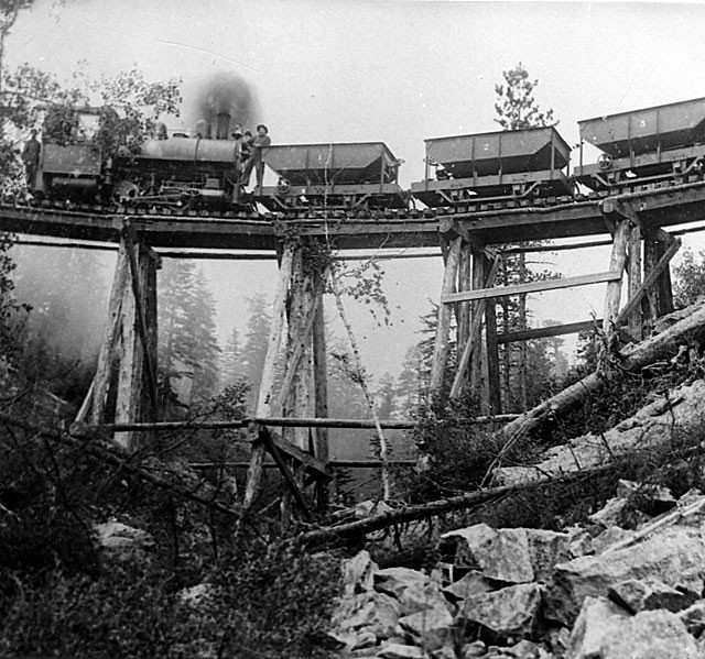
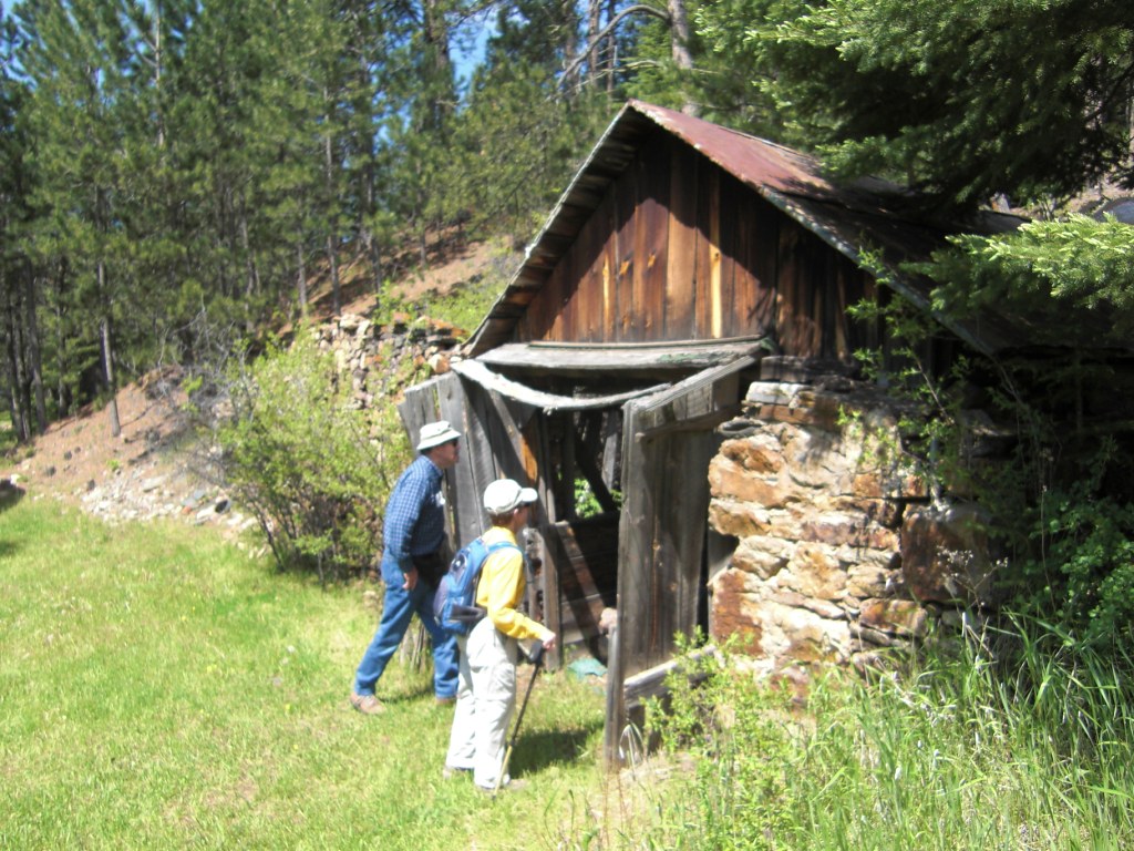
On June 13 twelve of our Black Hills Explorers toured the Galena, SD mining town ruins and got in about five miles of healthy hiking on a beautiful sunny day in the process.  Here are some images from our trip.


For more photo's click here.


The Black Hills Explorers meet at 8:15AM every second Saturday at the Canyon Lake Senior Center.  Before attending you should call the leader, Lee Alley at 605.863.0806 or send an email to Lee@LeeAlleyRealEstate.com.  That way you can get tips on where we're going, what to wear, etc.  Also, please stop by the Canyon Lake Center at 2900 Canyon Lake Dr to sign up during the week before.  They will ask you to post a $5 fuel-cost share for the Center's van which we use.

5/14/11

SENIOR EXPLORERS' FLUME TRAIL GEOCHACHING

The Canyon Lake Center's Black Hills Explorers set out on Saturday, May 14 to locate a hard-to-find treasure box hidden along the Flume Trail.  

Ten of us went on this snow-misty 7.5 mile trek, including some steep-slope rock-scrambling in search of geochached treasure.  Our youngest on this outing was 61 and the eldest was 84.  NOTE:  The 84-year old recently returned from summiting 19,000-ft Mt. Kilimanjaro in Africa.  That's nearly a mile higher than Colorado's highest peaks!.


Our GPS expert Clint VanBlaricum showed us all how to use the GPS, then he even "broke the code" and was the first one to locate the sneaky little treasure hidden under rocks off-trail.  We took a marble from the box, and left an LED flashlight.  But we brought home some great memories, including new GPS and geocaching skills, and great respect for the tenacious vigilance of our fearless GPS leader.

Each outing is the second Saturday of the month.  Our next outing is Saturday, June 11, leaving the Canyon Lake Center at promptly 8:30am, returning mid-afternoon.  We will tour an historic Ghost town or two, from the old mining and logging days.  For more information, call the Explorers' leader, Lee Alley at 863-0806, or email to Lee@LeeAlleyRealEstate.com.

10 Brave and Cagey GPS Sleuths (including Lee, holding camera)

Up and up we went, in search of geocaching riches.

Spirits ran high, anticipating great wealth.

But then, reality set in.  We had to read our maps and GPS's !!!

Gee, I dunno.  It could be up there.

Then Coach Clint, GPS expert stepped in to help.

Which way did he say is 'up'?

Let's just let him find it.

And...He did !

Coach Clint, the GPS expert and treasure hunter extraordinaire'.

Heading back home.